LABORATORIES
Laboratory of Mineralogy and Petrology
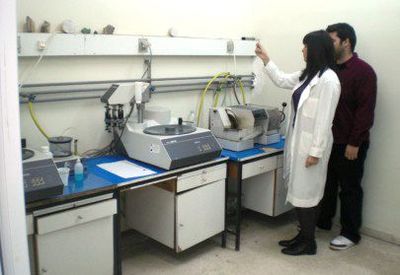
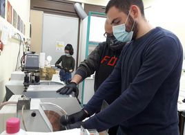
The Laboratory of Mineralogy and Petrology carries out basic and applied research and projects related to basic and applied research including the development of environmental and industrial applications. Its main activities include sampling and processing of rocks and minerals, determination of the internal structure of minerals, qualitative and quantitative determination of the chemical composition of rocks and minerals as well as chemical analyses of surface and subsurface fluids and gases. Determination of physical properties of geological samples such as crystal dimensions, shape, orientation, and intergrowth also takes place. In addition, the laboratory determines physical/mechanical properties of rocks and minerals and runs gemological analyses to examine the quality of precious and semiprecious stones. The infrastructure is available for research and education to undergraduate and postgraduate students and includes:
Equipment for sample preparation (jaw crusher, cutting saw, lapping system, polishing system, mortar grinder, ball mill, hydraulic press (25T) and pellet press)
Various bench top analytical instruments (pH-meter, conductivity meter, colorimeter, microhardness tester)
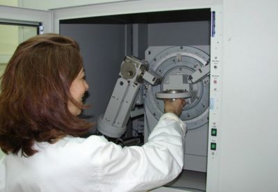
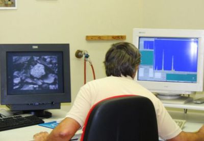
X-Ray Diffractometer,
ED & WD X-Ray Fluorescence Spectrometers
Direct Current Plasma Atomic Emission Spectrometer,
Transmitted-light polarizing microscopes equipped with digital cameras
- Dark room for Optically Stimulated Luminescence (infrared).
Laboratory of Historical Geology and Palaeontology
The Laboratory of Historical Geology and Palaeontology (LHGP)
is one of the oldest in the University. To this day, it plays a very important role in education and scientific research of the Section, in topics such as Palaeontology, Micropalaeontology, Stratigraphy, Sedimentology, Historical Geology, Palaeoecology and Ecostratigraphy. The Laboratory facilities include a modern thin section lab, a modern lab for the retrievement and preparation of fossils and microfossils as well as the conservation and creation of moulds/casts. There is also a modern lab for the analysis of sedimentary basins.
For the educational and research needs of the Section, the Laboratory also includes an e-teaching hall/room, with 24 computers and stereoscopes, 5 polarizing microscopes, three of which are connected to computers, and a Scanning Electron Microscope (SEM) connected to an X-ray Microanalysis system (WDS).
The laboratory may provide the following services: a) thin sections of rocks, sediments and fossils; retrievement and preparation of fossils; construction of fossil casts, b) identification of nano-, micro-, macro- fossils, c) analysis of sediments and sedimentary environments with applications in Hydrocarbon and water resources research, d) analysis of texture, composition, granulometry and identification of inorganic and organic composites of sediments, e) preparation of samples for C, O and S stable isotope analysis in sediments, f) digital logging and mapping of aqueous floors, g) stereotransportation (sedimentation) and hydrodynamic parameters measurements and h) protection of Geological Heritage.
Laboratory of Geoscience Teaching and Learning
The Laboratory of Geoscience Teaching and Learning (LAGETEL) was established with the main purpose of promoting a holistic approach to geoscience education, and achieving geoscientific literacy of society as a whole, which will contribute to the rational management of geo-environmental challenges.
The goals and areas of activity of the Laboratory are:
a) Meeting the educational needs (at undergraduate and postgraduate level) of the Section of Historical Geology - Palaeontology and the Department of Geology and Geoenvironment, as well as of other Departments of the National and Kapodistrian University of Athens, and/or of other educational institutions of the country, in the scientific field of Geoscience Education.
b) The development and promotion of basic and applied research on the Geoscience Education. In the context of basic research, principles, procedures and general/specific problems of Geoscience teaching and learning are studied and relevant studies are carried out. In the context of applied research, multidisciplinary approaches are adopted in order to produce innovative methods of teaching Geoscience at each level of education.
c) The promotion of cooperation with primary and secondary education in order to train and support teachers and students and to familiarize them with modern methods of teaching Earth Sciences. Indicatively, relevant actions may include: provision of specialized educational Matterial, development of IT applications, implementation of pilot educational interventions, etc.
d) The promotion of cooperation with other scientific disciplines (such as Pedagogy, Psychology, Sociology, etc.), with the aim of highlighting the multifactorial dimension of Geoscience teaching and learning. For the implementation of the above, the Laboratory organizes conferences, symposia, seminars, summer schools and workshops, conferences, lectures, and other scientific events, as well as special publications and editions, and invites Greek and foreign internationally recognized scientists, teachers and researchers.
e) The encouragement of socially multi-level actions aiming at the dissemination of geoscientific knowledge and the interconnection of the Laboratory with society. Familiarizing society as a whole with geological concepts is a prerequisite for understanding the geo-environmental challenges (e.g., floods, landslides, desertification, etc.) that the country is called to face. Education is the first stage in dealing with these challenges in a rational way. In this direction, the Laboratory develops all forms of cooperation (educational, research, writing, etc.) with public and private entities (e.g., local government, scientific/social/business organizations, etc.).
Laboratory of Physical Geography
The Laboratory of Physical Geography (LPG) deals with air-sea-land interactive processes forming the earth’s surface morphology (sub-aerial and sub-aqueous), i.e. river deltas, beach zones, fluvial geomorphology, morphotectonic processes, karstification, aeolian processes, geoarchaeological studies, coastal indicators of relative sea level changes, climate change (past, present and future), coastal oceanography, sediment dynamics, photogeology, remote sensing and GIS applications. .
It is equipped with:
- autonomous driller of fine-grained sediments,
- sieving analysis (dry and wet),
- autonomous continuous recording tidal gauge,
- manual operated current meter
- thermo-salino-meter,
- portable weather stations,
- GPS
- Tachymeter
- Software: SPS (statistics), MATLAB (incl. fuzzy logic tools), ERDAS (analysis of satellite images) CEDAS (nearshore hydrod dynamics), DAVIS (weather station software), ArcGIS (handling, interpreting, presenting geo-data.
Laboratory of Climatology and Atmospheric Environment
The Laboratory of Climatology and Atmospheric Environment (LACAE) specialises in the study of climate change on various time and space scales, urban climatology, studies on the ozone layer, measurements of ultraviolet radiation, meteorological parameters and air quality, climatic effects from aircraft emissions and impacts of weather/climate variability and air quality on human health. The members of LACAE have long experience in teaching in undergraduate and postgraduate courses and have supervised many undergraduate and postgraduate theses in the fields of climatology and the atmospheric environment.
It is equipped with:
- One Brewer MK IV monochromator measuring columnar amounts of ozone, SO2 and NO2.
- Two Yankee UV-B instruments measuring solar erythermal doses
- Instruments measuring atmospheric pollution (CO, CO2, NO2, PM)
- A complete autonomous/automatic meteorological station.
- A portable meteorological station
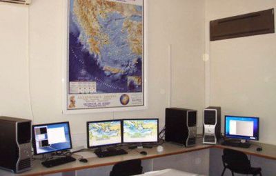
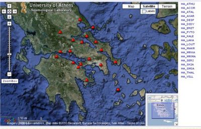
Laboratory of Seismology
The Laboratory of Seismology was established in 1929 in order to contribute to the education of students attending the Faculties of Physics and Natural Science, as well as in monitoring and researching the seismicity of Greece.
The Scientific and Technical Staff of the Laboratory has frequently been commended by Civil Authorities and the University Administration for its immediate response and major contribution in the relief operations and research of major destructive earthquakes. Their expertise is reflected in numerous publications, a multitude of research and civil protection programmes, extensive collaboration with international research and educational establishments and consultancies of public and private sector companies.
The Laboratory maintains the state-of-the-art ATHENET network, comprising 32 stations in Central Greece and the Cyclades (real time seismicity at Follow this link). It also possesses an extensive inventory of seismometric and accelerometric equipment, as well as data analysis facilities.
The principal teaching and research activities of the Laboratory are:
- Seismicity monitoring.
- Engineering Seismology and earthquake hazard analysis (including microzonation, vulnerability analysis and strong ground motion analysis, ).
- Physics of the earthquake source and earthquake prediction.
- Seismotectonics, Geodynamics and Earth System Science.
- Macroseismology, Historical Seismology and Archaeoseismology.
- Preparedness and protection against earthquake disasters, including the training of students, schools and the general public at the SEISMOPOLIS earthquake simulation centre
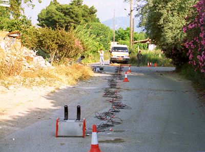
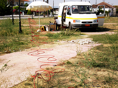
Laboratory of Geophysics
The Laboratory of Geophysics LG) was established in 1999; its mission is:
- To provide high level practical training (laboratory and field exercises) and modern analytical skills, as part of the geophysics courses offered by the Section, at the under- and post-graduate levels.
- To support research with state-of-the-art instrumentation and analytical facilities.
- To offer advanced geophysical services to public and private sector patrons, requiring the application of state-of-the-art or cutting edge technologies.
During the recent few years, significant effort has been directed towards the development of modern/high resolution exploration technologies and geophysical data analysis software. The hitherto, teaching and research activities of Laboratory can be summarized as follows:
- Methodological developments in near-surface and deep geophysical exploration methods.
- Environmental and Engineering geophysics
- Geothermal and other energy resource exploration
- Mineral resource prospecting.
- Physics of the Earth’s interior – determination and analysis of Earth structure at all depth scales.
- Physics of the earthquake source and earthquake prediction
- Geomagnetism, Geoelectromagnetism and Palaeomagnetism
- Space borne applications in the Earth Sciences and Geodynamics (DGPS, SAR/DINSAR, thermal imaging etc.).
- Geophysical software development.
- Earth System Science.
The Laboratory has developed multiple cooperative ties with corresponding national and international research establishments and academic institutions. It is also actively involved in outreach and dissemination of scientific information by organizing seminars, symposia and lectures for scientists and the general public. Moreover, it offers a broad range of geophysical services to public and private sector establishments, with particular reference to engineering and environmental applications, mineral and groundwater resource prospecting and geothermal prospecting.
Laboratory of Economic Geology and Geochemistry
The Laboratory of Economic Geology and Geochemistry supports and facilitates research activities involving sampling and chemical analysis as well as mineralogical analysis of a variety of geological samples (rocks, minerals, ores, soil, sediment, water etc.). Laboratory infrastructure includes:
- Manually operated systems for sample and microscopy specimen preparation (crushing, screening and splitting bulk samples, pulverizing and homogenizing subsamples to prepare them for chemical analysis; thin and polished section preparation)
- Chemical laboratory equipped with various instruments for sample dissolution, microwave digestion, leaching experiments, filtration, high temperature sample treatment, sample storage and incubation etc.
- Atomic Absorption Spectroscopy unit operated in flame and graphite furnace modes
- Scanning Electron Microscopy unit equipped with a SEM-EDS microanalysis system
- X-Ray Diffraction unit
- Flame photometer
- Bench -top and portable spectrophotometers
- Optical microscopes
- Fluid inclusion- microthermometry unit equipped with optical microscope and digital monitor
Laboratory of Tectonics and Geological Mapping
The Laboratory of Tectonics and Geological Mapping covers the educational and research needs of the Section and the Department in the fields of Tectonics, Structural Geology, Geological Mapping, Hydrology, Hydrogeochemistry and Soil and Rock Mechanics. Within this frame we develop educational curricula and conduct basic and applied research; cooperate and exchange scientific knowledge with other academic or research institutions from Greece and abroad; organize seminars, symposia, conferences, and lectures; provide services to external bodies from the public and the private sector.
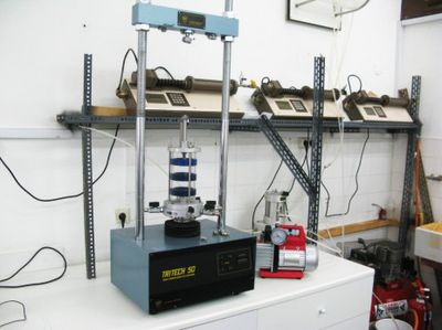
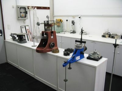
Ample laboratory space is available for various activities including full IT support supplemented by modern computing and printing facilities, testing of physical and mechanical properties of rocks and soils and chemical analysis of water samples. Available equipment includes a variety of instruments for field research, a total station, auger corers, triaxial, uniaxial, point and unimpeded loading apparatuses, rock sample corer, portable stations for chemical analysis of water samples, turbidity meters, groundwater samplers, etc. Efforts are constantly made for the upgrading of the existing infrastructure.
Laboratory of Remote Sensing
The Laboratory of Remote Sensing (LRS) was established in order to meet the educational and research requirements of the Department of Geology during the early 1990’s. Its research interests expand in the fields of modern space-borne Earth Observation Systems associated with the disciplines of Geodesy (Satellite Geodesy), Surveying, Photogrammetry, Digital Cartography and Remote Sensing. In general, the purpose and function of the LRS within the University of Athens and the Department of Geology and Geoenvironment, is the following:
- To satisfy under- and post-graduate educational requirements of the Department.
- To develop teaching and research curricula for the post-graduate study programmes.
- To pursue basic and applied research aiming at:
- The development of techniques and applications associated with the Country’s needs,
- The creation of opportunities for collaboration between the Academic staff and the Industry,
- To pursue and promote collaborative research between researchers of Hellenic Universities and Research Institutions,
- To provide services in accordance with Law 159/1984.
Current activities of the LRS members, include GPS measurements and Radar Interferometry (both conventional and advanced InSAR (PS and Stacking), including satellite imaging analysis (LANDSAT, ASTER, IKONOS, QUICKBIRD) and Orthorectification.
Laboratory for Prevention and Management of Natural Hazards
The Laboratory on Prevention and Management of Natural Hazards was established in 2003 within the Department of Geology and Geoenvironment of the University of Athens. The Laboratory participates in a number of research projects financed by national, European or other international and bilateral organizations. Current activities focus on emergency planning, development of action plans, seismic hazard, tsunamis, forest fires, floods, landslides and volcanic hazard. The scientific activities of the Laboratory include the organization of seminars, lectures, symposia and related disseminating scientific activities involving the scientific as well as the social sector. It is an educational and research unit utilized by the undergraduate students of The Department and the Postgraduate Studies Programme on Prevention and Management of Natural Hazards.