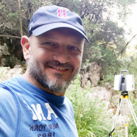
EMMANUEL VASSILAKIS

Emmanuel Vassilakis
Position: Faculty Member
Rank: Assoc. Professor
Section of: Geography and Climatology
Scientific Topic: Remote Sensing and Tectonic Geomorphology
Tel: +30 2107274400, +30 2107274322
e-mail: evasilak@geol.uoa.gr
Personal Webpage: http://scholar.uoa.gr/evasilak
Research Interests
Close-range remote sensing, UAS, GIS, Web-GIS, RTK-GNSS, Terrestrial Laser Scanner, LiDAR, MATLAB, Python, Speleology
Indicative Teaching Topics
Undegraguate Program
- Geographical Information Systems and Principles of Remote Sensing
- Geomorphology
- Geological Mapping
- Remote Sensing – Photogeology and Mathematical Geography
- Karst Geomorphology and Principles of Speleology
Postgraguate Program "Earth Sciences and the Environment"
- Remote Sensing and Satellite Data Applications
- Applied and Karst Geomorphology
Postgraguate Program "Environmental, Disaster and Crisis Management Strategies"
- State-of-the-art technologies and tools for research and management
Postgraguate Program (Department of Biology)
- Spatial analysis with Geographical Information Systems - Remote sensing techniques
Bi-institutional Postgraguate Program "Water, Biosphere and Climate Change" (in collaboration with International University of Greece)
- Geoinformation systems and water resources management
Postgraguate Program "Geographic Information Systems"
- GIS & Remote Sensing
Indicative Publications
Anifadi, A., Sykioti, O., Koutroumbas, K., Vassilakis, E., Vasilatos, C., Georgiou, E., 2024. Discrimination of Fe-Ni-Laterites from Bauxites Using a Novel Support Vector Machines-Based Methodology on Sentinel-2 Data. Remote Sensing, 16(13), 2295, DOI:10.3390/rs16132295
Mavroulis, S., Argyropoulos, I., Vassilakis, E., Karydis, P. & Lekkas E. 2023. Earthquake environmental effects and building properties controlling the degree and distribution of damage in Turkey caused by the 6 February 2023 Eastern Anatolia earthquakes. Geosciences, 13(10),303, DOI:10.3390/geosciences13100303
Diakakis M, Mavroulis S, Vassilakis E, Chalvatzi V. 2023. Exploring the Application of a Debris Flow Likelihood Regression Model in Mediterranean Post-Fire Environments, Using Field Observations-Based Validation. Land, 12(3):555. DOI:10.3390/land12030555
Anifadi, A., Sykioti, O., Koutroumbas, K. & Vassilakis, E., 2022. A Novel Spectral Index for Identifying Ferronickel (Fe–Ni) Laterites from Sentinel 2 Satellite Data. Natural Resources Research, 31(2); DOI:10.1007/s11053-022-10055-6
Vassilakis, E., Kaviris, G., Kapetanidis, V., Papageorgiou, E., Foumelis, M., Konsolaki, A., Petrakis, S., Evangelidis, C.P., Alexopoulos, J., Karastathis, V., Voulgaris, N., Tselentis, G.-A., 2022. The 27 September 2021 Earthquake in Central Crete (Greece) - Detailed Analysis of the Earthquake Sequence and Indications for Contemporary Arc-Parallel Extension to the Hellenic Arc. Applied Sciences, 12(6), 2815; DOI:10.3390/app12062815
Frank, A., Frei, R., Triantaphyllou, M., Vassilakis, E., Kristiansen, K. & Frei, K. 2021. Isotopic range of bioavailable strontium on the Peloponnese peninsula, Greece: A multi-proxy approach. Science of The Total Environment. 145181. DOI: 10.1016/j.scitotenv.2021.145181
Vassilakis, E., Foumelis, M., Erkeki, A., Kotsi, E. & Lekkas, E. 2021. Post-Event Surface Deformation of Amyntaio Slide (Greece) by Synergistic Analysis of Remotely Piloted Airborne System Imagery and SAR Interferometry. Applied Geomatics, 13(1), 65-75. DOI: 10.1007/s12518-020-00347-y
Nastos, P., Vassilakis, Emm., Nastos, M., Charalampopoulos, I. & Matzarakis, A., 2017. Assessment of continuous Sky View Factor based on ultra-high resolution natural color images acquired by Remotely Piloted Airborne Systems for applications in an urban area of Athens. International Journal of Remote Sensing, 38, 5814-5829, DΟΙ: 10.1080/01431161.2017.1346845
Bradley, K. E., Vassilakis, E., Hosa, A. & Weiss, B. P. 2013. Segmentation of the Hellenides recorded by Pliocene initiation of clockwise block rotation in Central Greece. Earth and Planetary Science Letters, 362, 6-19, DOI:10.1016/j.epsl.2012.11.043
Vassilakis, Emm., L. Royden & D. Papanikolaou, 2011. Kinematic Links from the Hellenic Trench to the Western Gulf of Corinth. Earth & Planetary Science Letters, 303, 108-120, DOI: 10.1016/j.epsl.2010.12.054